
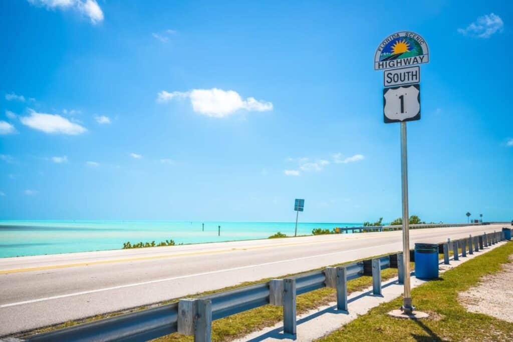
The Florida Keys Overseas Highway carries U.S. 1 through the island chain to Key West. Its commonly cited 113-mile length and 42 bridges describe the highway through the Keys; a drive starting in Miami also includes the mainland approach. Plan the trip around a few chosen stops, with enough time to leave the car and explore. Florida Keys’ official route overview explains the highway’s extent and mile markers.
Route order
Key Largo → Islamorada → Marathon → Bahia Honda → Key West
Time to reserve
A full day for selected stops; two or three days for a less compressed trip.
Before booking
Choose your pickup and return locations, then compare the full rental cost.
How long is the Overseas Highway, and how long does the drive take?
The key distinction is your starting point. The official tourism description counts mile markers down from 113 at the Miami-Dade–Monroe county line to 0 at Fleming and Whitehead streets in Key West. The separately defined Florida Keys Scenic Highway corridor starts at mile marker 110, north of Jewfish Creek Bridge. Those different boundaries explain why you may see both 113 and 110 miles quoted.
| Starting point | Driving allowance | What to add |
|---|---|---|
| Miami to Key West | Around 4 hours as a starting estimate in favorable conditions. | Your exact Miami departure point, traffic, rental pickup, breaks and sightseeing. |
| Key Largo to Key West | For planning, reserve around 3 hours before sightseeing; replace this allowance with live navigation for your address. | Time at each stop, parking and any road delays. |
| A scenic trip through the Keys | Reserve the day rather than scheduling activities against the minimum drive time. | An overnight stay if you want several long stops and time in Key West. |
VISIT FLORIDA’s travel guide gives about 3.5–4 hours for Miami to Key West. The three-hour Key Largo allowance above is an itinerary planning recommendation, not a measured live journey time. Check both your southbound drive and your return separately.
If you are collecting a rental car in Miami, start the road-trip schedule when you expect to leave the rental location. Landing time still leaves baggage collection, the journey to the counter and vehicle handover to complete.
Which Overseas Highway stops fit your trip?
Choose stops by the time you can spend there. A reef excursion, a short bridge walk and a beach afternoon require different schedules. The order below follows a southbound drive; reverse it for the return journey.
| Stop | Choose it for | Time to reserve |
|---|---|---|
| Key Largo | John Pennekamp Coral Reef State Park and an optional reef excursion. | A few hours for a boat trip, plus the operator’s check-in time. |
| Islamorada | A meal and an unhurried break in the Upper Keys. | About 60–90 minutes for a meal stop. |
| Marathon / Old Seven Mile Bridge | A walk with bridge views; a separate Pigeon Key visit if booked. | About 30–60 minutes for a short out-and-back walk; longer for a tour. |
| Bahia Honda State Park | Beach time and a walk to the historic bridge viewpoint. | About 1–2 hours for a brief visit, or a larger part of the day for the beach. |
| Key West | Park the car and explore Old Town. | Several hours or an overnight stay. |
These stop allowances are planning suggestions, not attraction operating times or guaranteed visit durations. On a phone, scroll the table horizontally to compare all three columns.
Key Largo: book reef time before adding more stops
John Pennekamp Coral Reef State Park’s entrance is at mile marker 102.5. The park concessionaire offers snorkeling and glass-bottom boat trips; its published snorkeling excursion lasts about 2½ hours round trip. Add check-in and time to change before continuing south. See the Pennekamp operator’s tour information for the current options and instructions.
Make a reef trip the main activity of that morning. Trying to combine it with a long beach visit, several other stops and a fixed Key West arrival time leaves little room for delays. Boat departures also depend on conditions, so keep the rest of that day flexible.
Islamorada: use the meal stop as a proper break
Islamorada works as a pause between Key Largo and Marathon. Choose one restaurant or waterfront venue with suitable parking, then put its actual entrance into your route. A fishing charter or another boat excursion changes this from a lunch stop into a destination that needs its own block of time.
Marathon: distinguish the two Seven Mile bridges
The modern Seven Mile Bridge carries U.S. 1 traffic. The nearby Old Seven Mile Bridge offers a separate recreational experience, with an open section used for walking and cycling. Visit Florida Keys highlights the restored old bridge among Marathon’s attractions. Use designated parking and the marked access points for the recreational section.
For a short stop, walk out only as far as your available time and the heat allow, remembering the return walk. Visiting Pigeon Key is a separate activity with its own tours, admission and operating arrangements. Check those details before treating it as an unscheduled bridge stop.
Bahia Honda: give the beach and viewpoint their own time
Bahia Honda State Park combines beaches with access to the Old Bahia Honda Bridge trail and its viewpoint. The park warns that day-use entry can close temporarily when capacity is reached, so an intended visit does not guarantee immediate admission. Arriving early is particularly useful on weekends and holidays.
The published day-use hours are 8 a.m. to sundown. For a vehicle carrying two to eight people, the official fee schedule lists $8 plus a $0.50 Monroe County surcharge per person. For example, two people in one car pay $9 under that schedule. Check the current fees before travel, and allow for an alternative stop if entry is temporarily paused.
Key West: choose parking before you reach Old Town
Decide where the car will stay before planning your first walk. Confirm whether your accommodation provides parking, what it costs and whether it is available before check-in. For a day visit, choose a public parking destination and check its current terms rather than circulating for an unspecified street space.
The official Florida Keys transport guide describes Old Town’s recreational areas as readily accessible on foot. Parking once gives you a more coherent visit than moving the car for each nearby attraction.
One day, two days or three days: choose a workable itinerary
For a first visit, two or three days make it easier to combine the drive with activities. The following outlines are editorial planning suggestions; confirm opening times, accommodation and any tours for your dates.
One day: selected stops, with an overnight in Key West
Start in Key Largo in the morning, take a meal break in Islamorada, then choose a short Old Seven Mile Bridge walk or a Bahia Honda visit before continuing to Key West. Add the second stop only if the day is running comfortably. A substantial reef excursion is better saved for another day. Starting in Miami adds the mainland approach and any rental collection time.
Two days: split the Upper Keys from the Lower Keys
Day 1: Travel from Miami to Key Largo, leave time for your chosen activity, then continue through Islamorada toward an overnight base in the Middle Keys. Day 2: Explore the Marathon bridge area, visit Bahia Honda if it fits, then continue to Key West. This is an outbound itinerary; plan another travel block for returning the car to Miami unless you have confirmed a different return location.
Three days: include a full day in Key West
Use day one for the Upper Keys and a Middle Keys overnight, day two for the bridge area and Bahia Honda before reaching Key West, and day three for Key West itself. This arrangement protects time for the destination at the end of the road. A subsequent drive back to Miami still needs its own allowance.

When is the best time to drive through the Florida Keys?
December through April is the clearest starting point if you prefer the drier season. The National Weather Service’s Florida Keys climate guide identifies December–April as the dry season, June–October as the wet season, and May and November as transition months. These are seasonal patterns; they do not guarantee clear weather for a particular drive.
In wetter months, leave flexibility around outdoor stops and boat excursions. During a dry-season visit, still check wind and marine conditions if you have booked time on the water. Choose the travel date for your activities and available time, then use the forecast to adjust the final schedule.
The Atlantic hurricane season runs from June 1 through November 30, according to National Weather Service hurricane guidance. Before leaving the mainland, review the Key West weather forecast and alerts. Follow official travel and evacuation instructions if a storm affects the Keys; a booked rental or hotel should not determine whether you continue into an affected area.
Driving and photo stops: what to plan before setting off
- Check the route before departure. Use Florida 511 traffic information alongside navigation for current incidents and road conditions. Recheck before the return journey, especially when a flight or rental return time is fixed.
- Use designated parking for photographs. Plan a viewpoint or recreational access area where you can leave the vehicle properly. Keep moving with traffic on the active road bridge and let a passenger handle any photographs taken from the car.
- Follow the signs on each section. Allow time for lower limits through communities, turning vehicles, crossings, cyclists and wildlife. Do not plan the whole drive around one assumed cruising speed.
- Save the essentials. Have stop entrances, your overnight address and the rental return location available before driving. Keep the rental company’s roadside-assistance contact with the booking details.
The parallel historic bridges also explain part of the landscape. Henry Flagler’s railway reached Key West in 1912; after the 1935 hurricane, parts of its infrastructure were adapted for the Overseas Highway, which opened in 1938. Florida State Parks’ railroad history explains why the recreational trail and older bridge structures are distinct from today’s traffic route.

How to choose a rental car for an Overseas Highway trip
Choose the car around passengers, luggage and your return plan. The route does not justify choosing a larger vehicle on scenery alone. Compare the total arrangement, including the days the car will be parked in Key West, before booking.
Match the vehicle to luggage and parking
Start with the rental car size guide if you are deciding between a compact, midsize car or a larger class. Check the actual baggage capacity for your group, particularly with a stroller, snorkeling gear or several large suitcases. If you choose a convertible, check luggage space with the roof in the position you expect to use.
Confirm the pickup and return as one booking decision
Compare a return to the original location with a one-way itinerary only when the supplier offers your chosen return point. Confirm any one-way fee, opening hours and vehicle restrictions in the quote. A plan to finish the drive in Key West does not by itself confirm that you can return the rental there.
Ask how tolls will be billed
The mainland approach and your selected roads can affect the tolls on the trip. Ask the supplier which toll-payment arrangement applies, when any service fee is charged and how to use your own compatible account if that option is allowed. SunPass’s rental-vehicle guidance explains that rental toll programs and their associated fees vary. Compare those terms before accepting a toll package.
Plan fuel and mileage around the return journey
Read the guide to rental fuel policies before choosing between prepaid fuel and a refill requirement. Include local driving and the return leg when checking any mileage allowance. Identify a practical refueling stop near the actual return location and keep the receipt if the contract requires it.
Inspect the car before driving south
Use the rental car pickup inspection checklist while staff are available. Record the fuel level, odometer and existing damage; test the air conditioning, lights and wipers, and confirm that your phone navigation and charging setup work. Raise any defect with the supplier before leaving.

Overseas Highway questions
Is the Overseas Highway a continuous bridge?
No. It is a road through the Florida Keys that links islands with multiple bridges. The commonly cited 113 miles describes the highway through the Keys, while the Seven Mile Bridge is one part of that journey.
Can you stop on the Seven Mile Bridge for a photograph?
Plan your photo stop at a designated parking and recreational access area. To spend time outside the car, use an open section of Old Seven Mile Bridge or another marked viewpoint. Do not treat the active U.S. 1 bridge as a sightseeing pull-off.
Do you need to keep the rental car while staying in Key West?
That depends on your accommodation and plans after arrival. Much of an Old Town visit can be done on foot. Compare parking and extra rental days with the availability and cost of returning the vehicle, plus transport for your onward journey. Confirm a permitted return location before booking.
How should you budget the final drive back to Miami?
Calculate it from your Key West departure address to the rental return location, using current traffic information. Add your fuel stop, vehicle handover and the airline’s required airport arrival time separately. Keep optional sightseeing out of a schedule that already has little spare time.
Route, park, weather and toll information checked against the linked sources on . Driving and stop allowances are planning guidance; check current access, conditions and supplier terms for your travel dates.

Jessica Malone is a passionate writer and travel enthusiast, specializing in affordable car rental solutions. With a keen eye for detail, she explores various aspects of cheap car rentals, offering readers practical tips and insights to maximize their travel experiences. Through her engaging articles, Jessica aims to empower travelers to make informed decisions and navigate the world of online car rental services with ease.




The concept of the open road truly captures the essence of what travel means to so many of us. I remember my own road trip along the Pacific Coast Highway; each breathtaking view felt like a reminder of nature’s beauty and the joy of spontaneity. There’s something incredibly freeing about choosing your own adventure, whether it’s a planned route or an unexpected detour.
The exploration of the open road is such a profound and timeless theme, and your reflections really resonated with me. There’s something undeniably liberating about the journey itself—when we think about the miles unfolding ahead, it evokes a sense of possibility that ignites our curiosity. Traveling by car allows us to interact with the world in a way that other modes of transportation can’t quite capture. The flexibility to deviate from our planned route, to make impromptu stops at roadside attractions, or simply to enjoy the changing scenery is what makes road trips so inherently mesmerizing.
I love how you captured the essence of road trips as a journey into the unknown! There’s something truly special about the open road that goes beyond just the act of driving; it’s a chance to reconnect with yourself and discover hidden gems along the way. I recently took a road trip along the Pacific Coast Highway, and the winding roads led me to breathtaking vistas and charming little towns I would have never found otherwise. It really emphasizes the point that the journey is just as important as the destination. Plus, with tools like RentaCar24, planning becomes a breeze, allowing for even more spontaneity! What are some of the most memorable stops you’ve made on a road trip?
Your exploration of the open road as a symbol of freedom really resonates with me. There’s something transformative about hitting the highway, isn’t there? I still remember a road trip I took along the Pacific Coast Highway last summer. The blend of stunning ocean views and the excitement of discovering unexpected spots really encapsulated that adventure spirit you describe.
The image of the open road really does encapsulate so much about our desire for exploration and connection. I find it fascinating how road trips can serve as both a physical journey and a metaphorical one, allowing us to escape routine and discover not only new places but also parts of ourselves. Taking the Florida Keys Overseas Highway as an example, the scenery is undeniably breathtaking, and it offers an opportunity to immerse in local culture—whether that’s trying fresh seafood or stopping at quirky roadside attractions.
Ah, the open road—the siren song that beckons even the most committed homebodies to pack their bags and hit the asphalt! There’s just something irresistibly romantic about cruising down a highway with nothing but a playlist full of guilty pleasures and a half-eaten bag of cheesy snacks at your side. Your post beautifully captures that spirit of adventure infused in every mile!
The notion of the open road as a symbol of freedom and adventure certainly resonates on many levels, especially in our increasingly digital and constrained lives. As someone who has taken numerous road trips, I can personally attest to the rush of spontaneity that comes from hitting the highway with nothing but a map (or a GPS on my phone) and a vague idea of where I’d like to go. That feeling of liberation, unsurpassed by other travel forms, is something I believe many share. Yet, while the allure of road trips is undeniably captivating, there’s a complexity to this experience that goes beyond mere adventure.
Your reflections on the allure of the open road resonate deeply with my own experiences. There’s something undeniably enchanting about the freedom that a road trip offers, isn’t there? It’s not just about the destination; it’s the uncharted paths we take, the unexpected stops, and the sense of discovery that comes with every mile.
The concept of the open road as a symbol of freedom and adventure certainly resonates with many. However, it’s fascinating to consider how our perception of that freedom has evolved with modern technology and societal norms. While road trips traditionally represent spontaneous exploration, today’s travelers often rely on navigation apps and social media to curate experiences, which can dilute the thrill of unplanned discovery.
Your reflections on the allure of the open road resonate deeply with me. There’s something distinctly liberating about the idea of hitting the highway, leaving behind the confines of everyday life, and embarking on an adventure where every bend or stretch could lead to something unexpected. I have many fond memories tied to road trips that have shaped my understanding of freedom and exploration.
Ah, the call of the open road! It reminds me of that time I just packed my trusty backpack and set off on a whim, no destination in mind. You know what they say—sometimes the best journey is the one that you just kind of “wing it.”
The open road truly has an enchanting effect, doesn’t it? I often find that road trips provide this unmatched blend of freedom and connection, not just with the places we visit but with the people we travel with. I remember a memorable trip along California’s Pacific Coast Highway, where every bend revealed staggering vistas and unexpected little towns that felt like hidden gems.
Your reflection on the allure of the open road truly resonates with me. There’s something almost magical about embarking on a journey, especially along routes as iconic as the Florida Keys Overseas Highway. The way you describe the freedom of travel mirrors my own experiences, where those winding roads have led to unexpected adventures and meaningful connections with both nature and people.